Case study Granville
The lobster fishery of the Granville Bay and its governance (France)
Contents
1. Presentation and history
The Bay of Granville (Figure 1) is an area that takes on a special significance because of its geographical situation. Indeed, it is a shared maritime border area between England (Jersey) and France (regions of Lower Normandy and Brittany). It is located west of the Cotentin and around Jersey[1]. The Granville Bay, also known as the Norman-Breton Gulf, takes its name from the town of Granville located in the department of Manche. Fishing in this maritime region, and lobster fishing in particular, is of particular importance. Lobsters are an iconic and very present species due to the numerous island groups and rocky shore platforms that provide shelter to one of the largest French lobster nursery habitats[2].
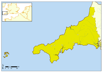
Figure 1 : Geographical situation of the Granville Bay[3]
The lobster (Homarus gammarus) is a crustacean that is found in waters spanning from Norway’s southern coastline to the north coast of Morocco. It is a solitary and very territorial animal that only lives in marine waters and with large populations being concentrated in the Western English Channel and around the British Isles. It lives on all rocky shores between 0 and 100 m, and sometimes up to a depth of 200 m. Lobster fishing, being a species with very high market value, is generally carried out using pots (or lobster pots) which are passive fishing gears that have very little impact on the environment, as well as nets but to a lesser extent. It is directly targeted during its fishing season but is also a bycatch of the brown crab and spider crab fisheries. The main fishing trades are that of coastal trapping and French small versatile fishing vessels. In the Granville Bay, the largest lobster fishing community is that of Lower Normandy, located mostly on the west coast of the Manche department. About 220 licences for large crustaceans are allocated annually in Lower Normandy. Only about sixty specialised lobster fishermen from the western part of the Cotentin navigate to the Norman and Anglo-Norman island groups for fishing. In addition to these Norman fishermen, Breton ships (from the departments of Ille et Vilaine and Côtes d' Armor) and ships from Jersey fish in the Granville Bay (Figure 1). In all, 239 vessels practice pot fishing in this bay[4][5]. It is unusual due to its cross-border positioning, as community fishermen have fishing rights in the area of Jersey and vice versa. The most important port in terms of landings of lobster is Granville (Figure 2) with 44 tonnes landed in 2013 (data from the FranceAgrimer Fish Market Network ([subattr_mots_cles___id_si:Mots-cl%C3%A9s=3083&filter[]=subattr_mots_cles___id_si:%223083%22 Réseau Inter Criée- FranceAgrimer])). This fishery is composed for the most part of vessels that are less than 12 meters in length and targets lobsters mainly between March and November. Fishermen mostly catch lobsters and spider crabs but also, incidentally, velvet swimming crabs and common littoral crabs.
- Figure 2 : Granville fish market
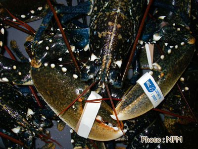
The lobster fishery of the Granville Bay is MSC certified with regard to its sound management and its healthy lobster stock (Figure 3). The MSC is a certification and eco labelling program that recognises and promotes sustainable fishing. 130 ships from Lower Normandy and Jersey are participating.
- Figure 3 : MSC certified lobster (photo : Normandie Fraicheur Mer)
2. Organisation of the governance
The governance of the fishery in this specific maritime area involves a co-management system that takes into account the cross-border nature of the fishing ground.
2.1 Governance in the French territorial waters
In Lower Normandy, a true co-management system prevails between administrative and occupational structures for the lobster fishery. In this system, the lobster resource management initiative originates mainly from the local users (Picault et al., 2014). Decision-making is participatory, thus giving stakeholders the opportunity to voice their positions. Fishermen enjoy a degree of autonomy because they hold some control over the management of the fishery[6]. However, the regulatory decision-making falls to the central (national level) or decentralised (regional level) administrations. The community of lobster fishermen of the Granville Bay in Lower Normandy is directly represented in terms of governance through the Regional Committee of Maritime Fisheries and Marine Fish Farms of Lower Normandy (Comité Régional des Pêches Maritimes et des Elevages Marins de Basse-Normandie - CRPMEM BN). In this region, there are no departmental Committees, as in Brittany for example (Picault et al. , 2014) but rather CRPMEM antennas (notably that of Granville for lobster). It is a structure that was officially created at the same time as all the regional Committees of France in 1991. However, a first institution had been created in Lower Normandy as early as 1980. The objective of the CRPMEM is to secure and manage fishing within 12 nautical miles , including through the introduction of regulations. Within this committee, the “Crustacean” Commission is the authority dedicated to the management of the lobster fishery in the region. It is a place of exchange between specialised fishermen. It also involves scientists who express their opinions on the issues that are addressed. The Committee has no decision-making power but rather a decisive role of recommendation, notably where regulations are concerned. It enables opinions to be fed back and to propose management measures that will be validated by the state at the level of the administration, through the Interregional Directorate for the Sea (Direction Interrégionale de la Mer -DIRM). This is how a system of licenses was established. The issuance of these depends on a set of eligibility criteria as defined by this Commission and by the “Shellfish” Commission of the National Committee of Maritime Fisheries and Marine Fish Farms (Comité National des Pêches Maritimes et des Elevages Marins - CNPMEM). Since 1993, vessels desiring to fish for lobster must hold a national license, which is mandatory for any vessel wishing to fish for crustaceans in French waters[7].
2.2 A cross-border management of the lobster fishery
The Bay of Granville has a rich history in terms of maritime law. Agreements in this area started in 1839 so as to define the maritime boundaries between the two countries and, thereby, three fishing grounds. In 1959, the British obtained sovereignty over the Minquiers by decision of the International Court of Justice in The Hague. Agreements were signed in July 2000 following recurring exchanges between the two countries since 1992[8]. These agreements, known as the “Granville Bay Agreements", delineate a marine border between France and Jersey. They also define a fisheries agreement taking into account both the boundaries and historical fishing rights [3]. From these agreements emerged the creation of the Granville Bay Joint Management Committee (Comité Consultatif Conjoint de Gestion de la Baie de Granville - CCCBG), which is a pioneering example of cross-border fisheries management. The CCCBG enables discussion between stakeholders of the fisheries sector. Its role is to build a maritime area with an internal management consistency. Its function is to ensure the effective conservation and management of fisheries resources in the sector governed by these agreements. This cross-border structure involves two states with a representation of the professionals of the fishing industry (Brittany and Normandy for France), the administration, and scientists. Fishermen therefore have a forum where they can exchange on different topics to find management consensus between Jersey and France for a given resource [3].
- ↑ LE GALLIC B., 1996. Conflits d’usage et régulation d’accès à la pêche : le cas du golfe Normano-Breton. Mémoire of DEA Economie et Politique Maritime, ENSAR, Rennes, 125 p.
- ↑ DELAYAT S., LEGRAND V., 2011. Les cantonnements de pêche. Projet MAIA (Marine protected areas in the Atlantic arc). Comité régional des pêches maritimes et élevages marins de Basse-Normandie, 51 p.
- ↑ 3.0 3.1 3.2 FLEURY C., 2006. Discontinuités et systèmes spatiaux. La combinaison île/frontière à travers les exemples de Jersey, de Saint Pierre et Miquelon et de Trinidad. Phd University of Caen. UFR Géographie, 624 p.
- ↑ LEBLOND E., F. DAURES, C. MERRIEN, S. DEMANECHE, S. LE BLOND, P. BERTHOU, 2013 (a). Activité 2011 des navires de pêche de la région Basse Normandie. Document realized for the project « Système d'Informations Halieutiques ». IFREMER Brest Edition, 9 p. [On line] http://sih.ifremer.fr/content/download/17680/115175/file/FICHE_LIEU_2011_ZAT_52_BN.pdf. Page consulted March 24, 2014.
- ↑ LEBLOND E., F. DAURES, C. MERRIEN, S. DEMANECHE, S. LE BLOND, P. BERTHOU, L. LE RU, 2013 (b). Activité 2011 des navires de pêche du quartier maritime de Saint-Malo. Document realized for the project « Système d'Informations Halieutiques ». IFREMER Brest Edition, 9 p. [On line] http://sih.ifremer.fr/content/download/17673/115140/file/FICHE_LIEU_2011_ZAT_13_CH.pdf. Page consulted March 24, 2014.
- ↑ FERRACCI F., 2011. Présentation et analyse d'une cogestion de la ressource halieutique au sein d'une aire marine protégée. Exemple de la réserve naturelle des bouches de Bonifacio. Document presented to get a master degree in environment and master in management of environment and sustainable development, 45 p. [On line] http://www.usherbrooke.ca/environnement/fileadmin/sites/environnement/documents/Essais2011/Ferracci_F__09-01-2012-2011_.pdf . Page consulted February 15, 2014.
- ↑ CORRE J., 2010. Recensement des bonnes pratiques des professionnels des pêches maritimes françaises. Final report, Comité National des Pêches Maritimes et Elevages Marins, 202 p.
- ↑ FLEURY C., 2011. Quand droits des pêcheurs et frontières marines interfèrent. Enjeux et conflits dans le golfe normand-breton. In dimension spatiale des inégalités, Regards croisés sur les sciences sociales de Backouche I., Ripoll F., Tissot S. et Veschambre V. Rennes, Presses Universitaires de Rennes, coll. Géographie Sociale, pp. 87-113.


