 |
 |
|
Cumacea distribution - Placedetails
| MRGID | http://marineregions.org/mrgid/3743 | ||||||||||
| Status | Proposed standard |
||||||||||
| Name |
|
||||||||||
| PlaceType | Archipelago | ||||||||||
| Latitude | 28° 31' 35.9" N (28.52665°) | ||||||||||
| Longitude | 15° 47' 25.8" W (-15.7905°) | ||||||||||
| Precision | 251863 meter | ||||||||||
| Min. Lat | 27° 38' 14.6" N (27.6374°) | ||||||||||
| Min. Long | 18° 9' 40" W (-18.1611°) | ||||||||||
| Max. Lat | 29° 24' 57.2" N (29.4159°) | ||||||||||
| Max. Long | 13° 25' 11.6" W (-13.4199°) | ||||||||||
| Source | (2001). The Times comprehensive atlas of the world. 10th ed. Times Books: London. ISBN 0-7230-0792-6. 67, 220, 124 plates pp. (look up in IMIS) | ||||||||||
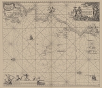
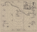
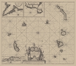
| Images |
|
||||||||||
| Relations |
|
||||||||||
| Map | |||||||||||
| Species occurring in any subarea of Canary Islands (11) |
Campylaspides canariensis Jones, 1984 Campylaspis rostellata Jones, 1974 Cumella (Cumella) echinata Jones, 1984 accepted as Styloptocuma echinatum (Jones, 1984) Cumella (Cumella) spicata Jones, 1984 Cumellopsis laevis Jones, 1984 Dasylamprops guanchi Reyss, 1978 accepted as Chalarostylis guanchi (Reyss, 1978) Hypocuma serratifrons Jones, 1973 Lamprops profundus Reyss, 1978 accepted as Alamprops profundus (Reyss, 1978) Leucon (Epileucon) pusillus (Bishop, 1981) Makrokylindrus (Adiastylis) alleni Reyss, 1974 Paracampylaspis platycarpus Jones, 1984 |
||||||||||
| Edit history | Last edited on 2014-08-19 09:07:05 by Vancraeynest Freek | ||||||||||
| [Google] [Google scholar] [Google images] |
Page generated on 2025-10-20 04:38:37 - contact: Les Watling


